


Cooper Voting District, Fairfax County, Virginia
About
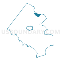
Outline

Summary
| Unique Area Identifier | 681457 |
| Name | Cooper Voting District |
| County | Fairfax County |
| State | Virginia |
| Area (square miles) | 4.40 |
| Land Area (square miles) | 4.37 |
| Water Area (square miles) | 0.03 |
| % of Land Area | 99.27 |
| % of Water Area | 0.73 |
| Latitude of the Internal Point | 38.96136070 |
| Longtitude of the Internal Point | -77.21664890 |
Maps


Graphs
Select a template below for downloading or customizing gragh for Cooper Voting District, Fairfax County, Virginia


Neighbors
Neighoring Voting District (by Name) Neighboring Voting District on the Map
- Churchill Voting District, Fairfax County, VA
- Great Falls Voting District, Fairfax County, VA
- Hickory Voting District, Fairfax County, VA
- Kenmore Voting District, Fairfax County, VA
- Langley Voting District, Fairfax County, VA
- McLean Voting District, Fairfax County, VA
- Montgomery Precinct 07-003, Montgomery County, MD
- Montgomery Precinct 10-007, Montgomery County, MD
- Montgomery Precinct 10-010, Montgomery County, MD
- Spring Hill Voting District, Fairfax County, VA
Top 10 Neighboring County Subdivision (by Population) Neighboring County Subdivision on the Map
- Dranesville district, Fairfax County, VA (114,174)
- District 7, Montgomery County, MD (97,177)
- District 10, Montgomery County, MD (36,837)
Top 10 Neighboring Place (by Population) Neighboring Place on the Map
- McLean CDP, VA (48,115)
- Potomac CDP, MD (44,965)
- Great Falls CDP, VA (15,427)
- Cabin John CDP, MD (2,280)
Top 10 Neighboring Unified School District (by Population) Neighboring Unified School District on the Map
Top 10 Neighboring State Legislative District Lower Chamber (by Population) Neighboring State Legislative District Lower Chamber on the Map
- State Legislative District 16, MD (114,427)
- State House District 53, VA (80,425)
- State House District 34, VA (74,627)
Top 10 Neighboring State Legislative District Upper Chamber (by Population) Neighboring State Legislative District Upper Chamber on the Map
Top 10 Neighboring 111th Congressional District (by Population) Neighboring 111th Congressional District on the Map
Top 10 Neighboring Census Tract (by Population) Neighboring Census Tract on the Map
- Census Tract 4803, Fairfax County, VA (7,105)
- Census Tract 7058, Montgomery County, MD (6,003)
- Census Tract 4705, Fairfax County, VA (5,403)
- Census Tract 7060.08, Montgomery County, MD (5,330)
- Census Tract 4802.01, Fairfax County, VA (4,592)
- Census Tract 4801, Fairfax County, VA (4,239)
- Census Tract 4701, Fairfax County, VA (2,732)
- Census Tract 4706, Fairfax County, VA (2,676)